Issued: Monday, May 13, 2024 8:00 am
Key Take-Aways Next Ten Days:
- Unsettled pattern continues over the next seven to ten days
- Rainfall slightly above normal for much of the region
- Temperatures slightly above normal across much of the region; a few areas near to slightly below normal mainly being the coastal areas of Southern New England into the Coastal Mid-Atlantic
Discussion: The upper level pattern across the Northern Hemisphere has set up in a way that allows unsettled conditions to dominate across the Northeast as well as a lack of sustained spring and summer-like temperatures. As we look through the next ten days; this upper level pattern across the Northern Hemisphere dose not change a whole lot as high latitude blocking remains in place across Northern Canada into the Gulf of Alaska. This will lead to continued periods of rain as well as high temperatures being below normal. To counter days of clouds and rain; if the nights are cloudy and or rainy; that can help keep low temperatures above normal which will help balance out the cooler than normal highs leading to some areas averaging normal temperature wise.
One thing is clear though through at least the next ten days; no heatwaves anywhere in the Northeast! Southern New England away from the coast potentially will have the warmest day out of the next ten tomorrow afternoon as afternoon high temperatures around 80 before cooler temperatures move in for late week and the upcoming weekend with our next disturbance moving out of the Great Lakes.
Let’s take a look at the temperature anomalies below over the next few days.
Today’s high temperature departures below.
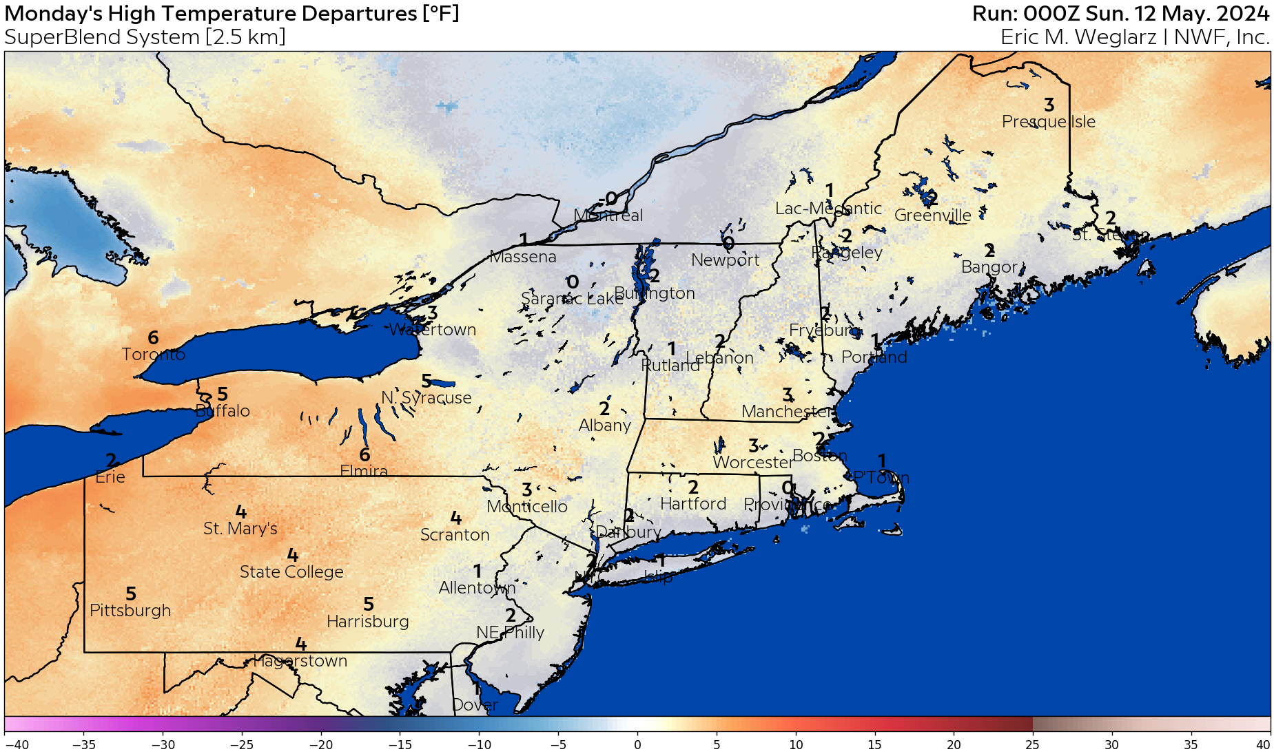
As you can see on the map above, High temperatures are forecasted to be slightly above normal across much of the region today with a few areas topping out just at average across Northern New England, Southern Coastal New England, and into a good part of New Jersey.
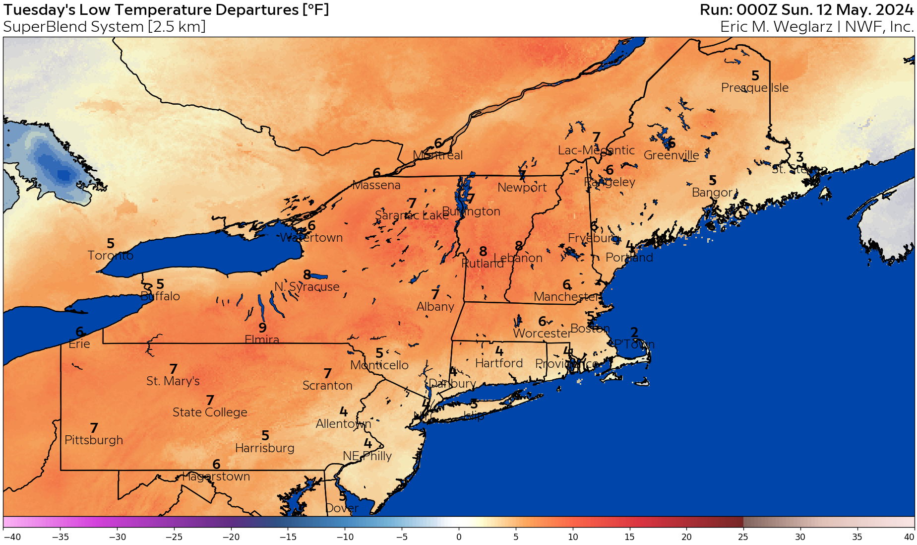
Looking into the Low temperature forecast for tomorrow on the map below, we can infer that clouds and a few rain showers tonight across the region will keep the Low temperatures several degrees above normal. Some locations may see Low temperatures close to ten degrees above normal!
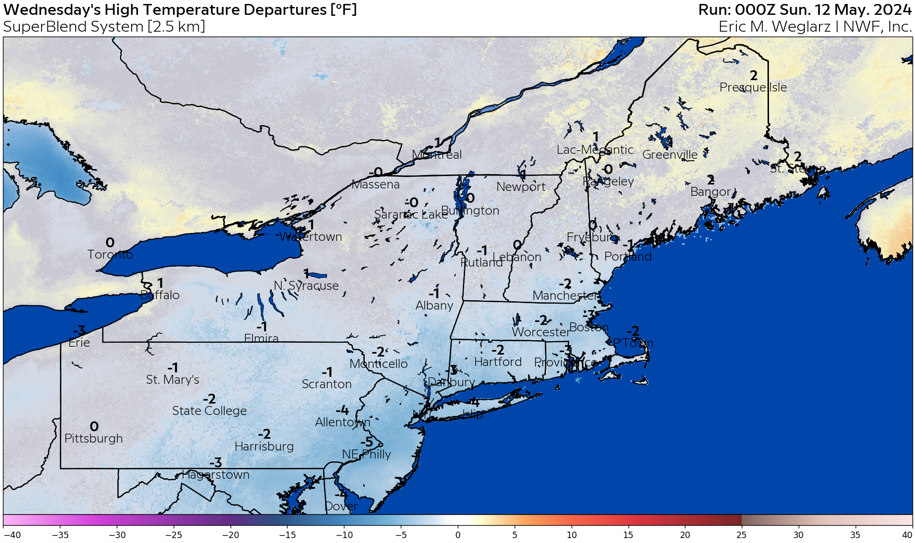
Jumping to Wednesday on the next page; we can see that with showers around as a storm system moves through the Mid-Atlantic, afternoon high temperatures will likely be a few degrees below normal across the Northeast with Northern New England seeing the best chances of temperatures a smidge above normal.
Longer range thoughts:
We are forecasting the month to finish with temperatures near normal with rainfall slightly above normal as our pattern remains active. There are some indications that this pattern lingers into the early June with a slow ease into summer temperatures and humidity.
Please note that we now have available have ten-day temperature anomaly graphics available for the northeastern domain on your energy analysis dashboard.
For daily updated degree day forecasts and degree day totals, please consult your individual market on our Energy Analysis Dashboard at: https://www.nationalweatherforecastinginc.com/main-login/
Questions? Call (201) 427-1119
Next Update: Next Monday or storm updates as needed!