Issued: Monday, April 7, 2025 9:00 am
Key Take-Aways Next Ten Days:
* Temperatures continue below normal MOST of this week
* Unsettled pattern continues most of this week – but no large-scale storms or wintery precipitation events
Discussion:
Low pressure will dominate the upper atmosphere across the northeastern United States over the next 7 to 8 days, keeping conditions largely unsettled. A series of mostly weak low-level systems will track beneath this upper-level storminess, bringing periodic precipitation. However, we will see a few breaks in the action, particularly on Tuesday and Wednesday.
Some areas will experience early spring snowfall, primarily across upstate New York, northern New England, and possibly the Berkshires. While this snow is not expected to be overly disruptive, modest accumulations could create slippery travel conditions, especially in parts of Maine and the higher elevations of Vermont and New Hampshire.
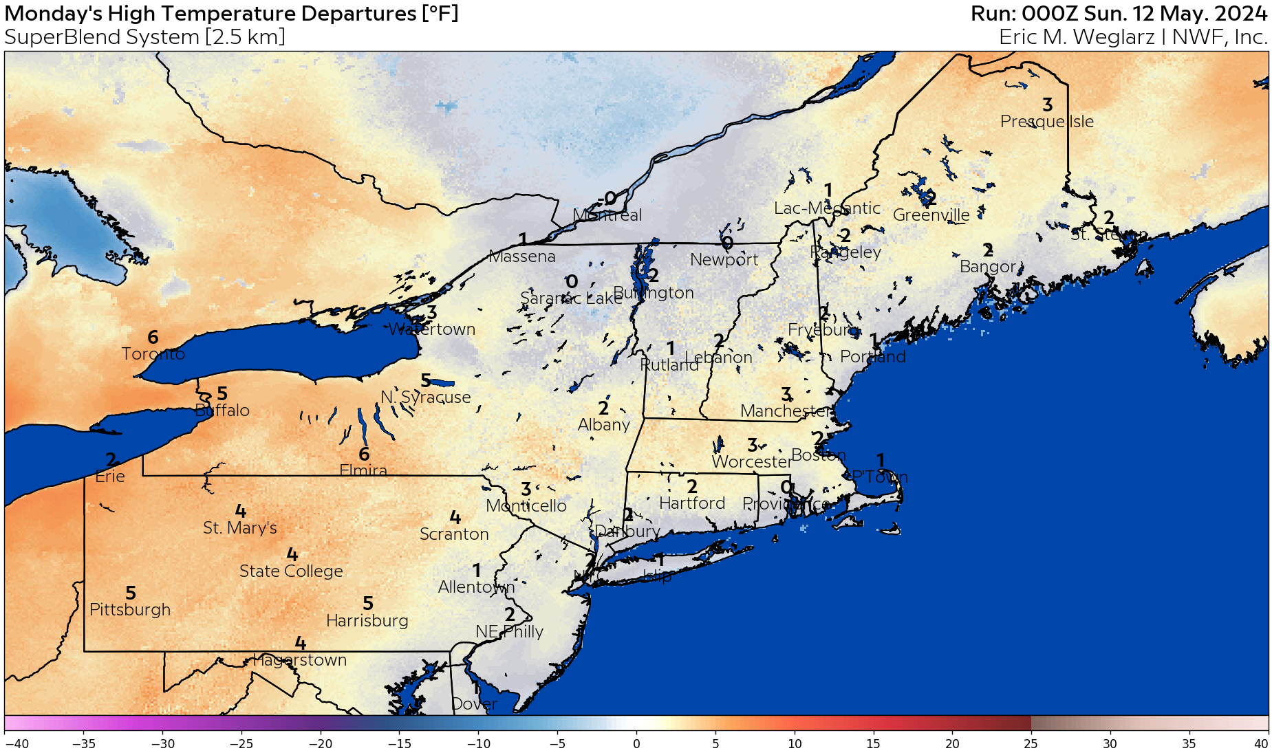
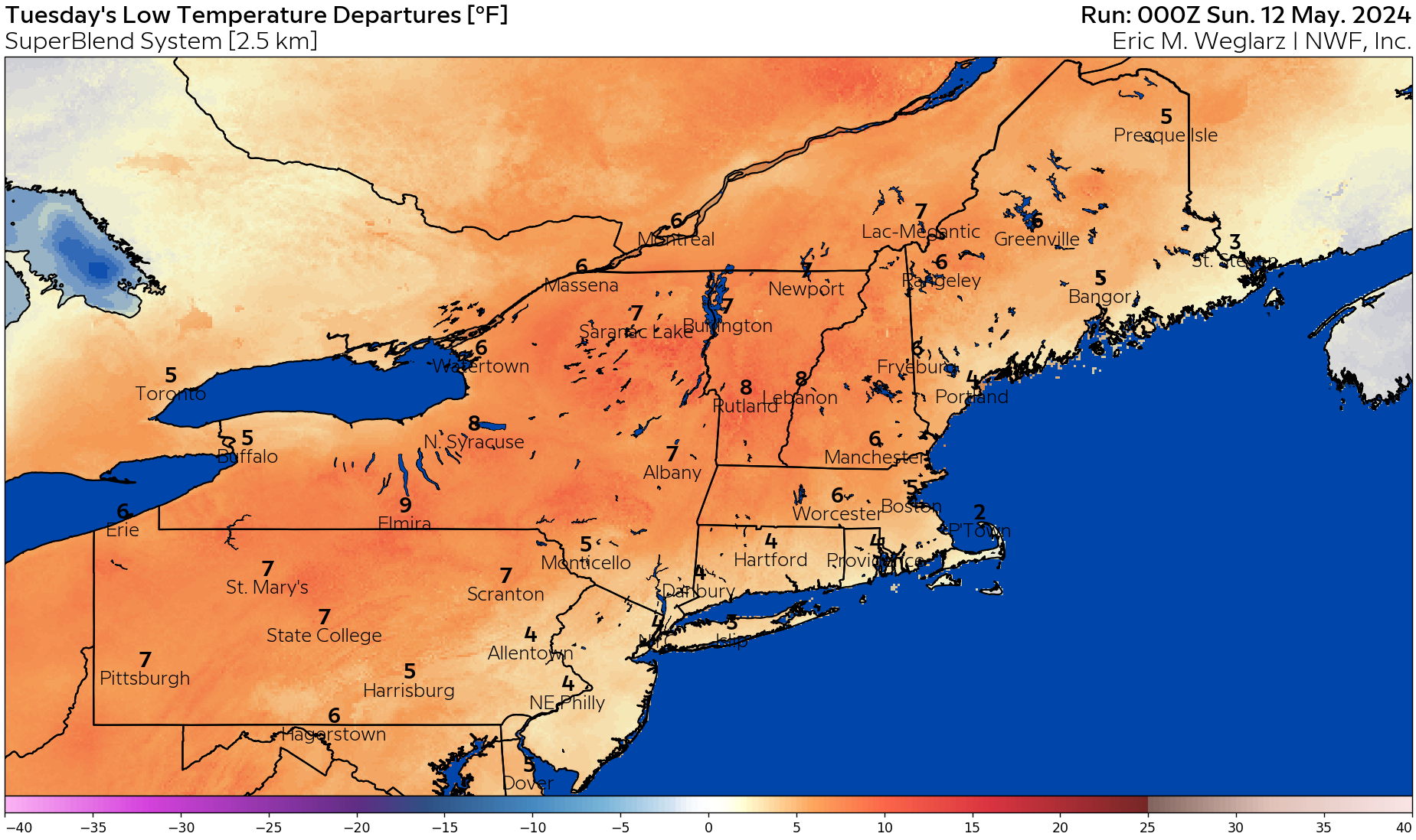
The most notable weather feature will be continued below-normal temperatures across the entire Northeast over the next seven days. The most significant negative temperature anomalies will be found in New Hampshire, Vermont, Massachusetts, western Connecticut, and much of New York and Pennsylvania. The following graphics illustrate these below-normal temperature trends.
Let’s take a look at the temperature anomalies below over the next few days.
Today’s high temperature departures below.
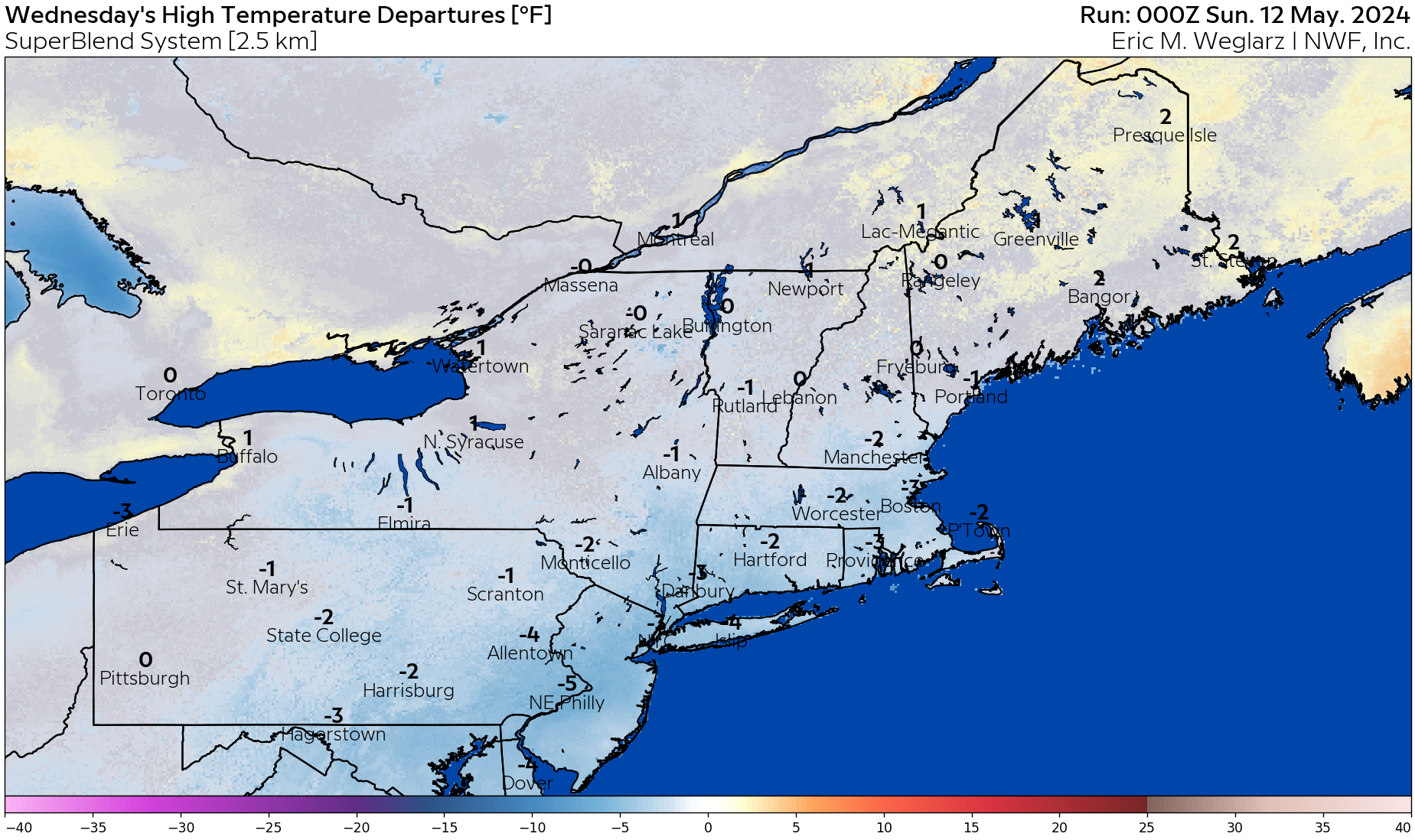
Fine weather is expected on Wednesday – but with a continuation of below normal temps regionwide.
Medium-Range Outlook:
Temperatures are expected to moderate to near-seasonal levels by late next weekend, with a brief period of slightly above-normal temperatures during the first half of next week. However, the overall trend points toward a return to below-normal temperatures into the third week of April.
At this time, no major storm systems are on the horizon, but with the persistent cold, we’ll need to stay vigilant—this time of year can be particularly unpredictable!
Longer-Range Outlook:
Seasonable to seasonably cool conditions are expected for the final ten days of April, with a continued trend toward slightly cooler-than-normal temperatures extending into the first ten days of May. The most significant temperature anomalies will likely be found across western Massachusetts, the Connecticut River Valley, northern New England, and areas to the west. Meanwhile, much of Maine is expected to see near-normal temperatures during this period. Above-normal precipitation is anticipated across most of the Northeast over the next six weeks, with the heaviest rainfall likely occurring in the Mid-Atlantic region and points southward.
Please note that we now have available have ten-day temperature anomaly graphics available for the northeastern domain on your energy analysis dashboard.
For daily updated degree day forecasts and degree day totals, please consult your individual market on our Energy Analysis Dashboard at: https://www.nationalweatherforecastinginc.com/main-login/
Questions? Call (201) 427-1119
Next Update: Next Monday or storm updates as needed!