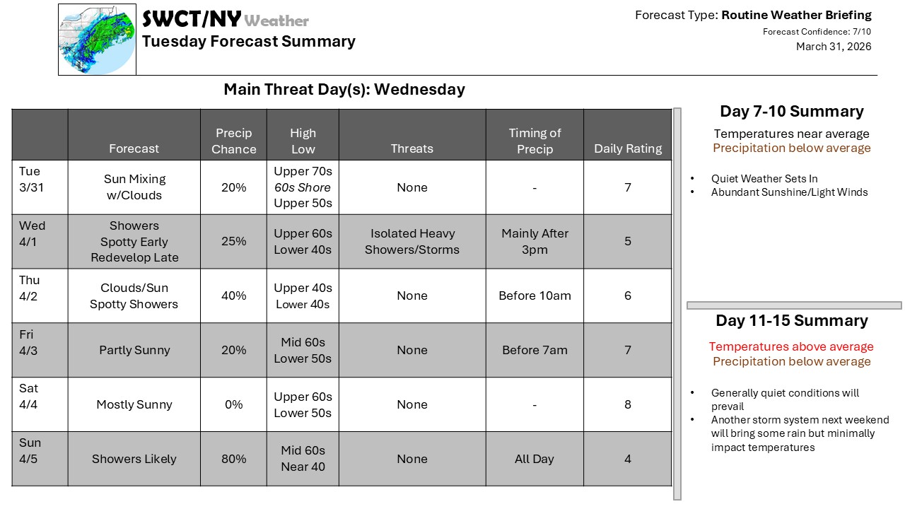
An unsettled weather pattern continues thanks to a nearly stationary front, stretching from the Northeast to the Southwest, though not in a straight line thanks to numerous waves of low pressure along it, buckling it one way or the other. North of the front, cold air remains; near the front, there’s rain, and south, it’s mild – and that’s where we are most of the time. The front does sag southward Wednesday Night, though, and we get into at least some of the cooler air after a few heavier showers. The “coldest” air does not approach – rain is still the most likely precipitation type. The next wave lives it back northward; a few showers roll in Thursday Night and we dry out and warm back up. The whole system finally swings through Sunday with quieter weather to follow.
Slightly cooler air, but much more settled weather will take over for the next week.
Be sure to update your account on the new swctweather.com/nationalweatherforecastinginc.com and watch for a resubscribe/renewal special in your inbox
-Phil
