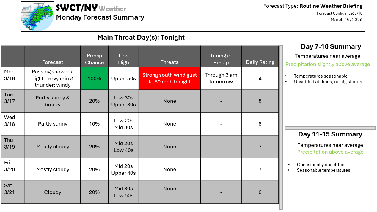
Good afternoon! A powerful storm system moving through the northern Great Lakes today & then through southern Quebec tonight brings us rain & breezy conditions today with rain; heavy at times tonight & strong south wind gust up to 50 mph. The peak of the winds are forecasted from 7 pm through 1 am out ahead of a powerful cold front which will move through from our west. Some tree damage & power outages are expected from the strong winds with even a low risk of a few rumbles of thunder late this evening. Once our cold front clears the region to our east by sunrise tomorrow; we’ll see temperatures fall from the low 50s into the upper 30s with less wind; but still breezy with west wind gusts up to 35 mph. The remainder of the week is overall settled with varying cloud cover & seasonable temperatures.
Joe Sciacca
Don’t forget to update your account on the new swctweather.com. Make sure to update your password so you can still login as we complete the transition process.
