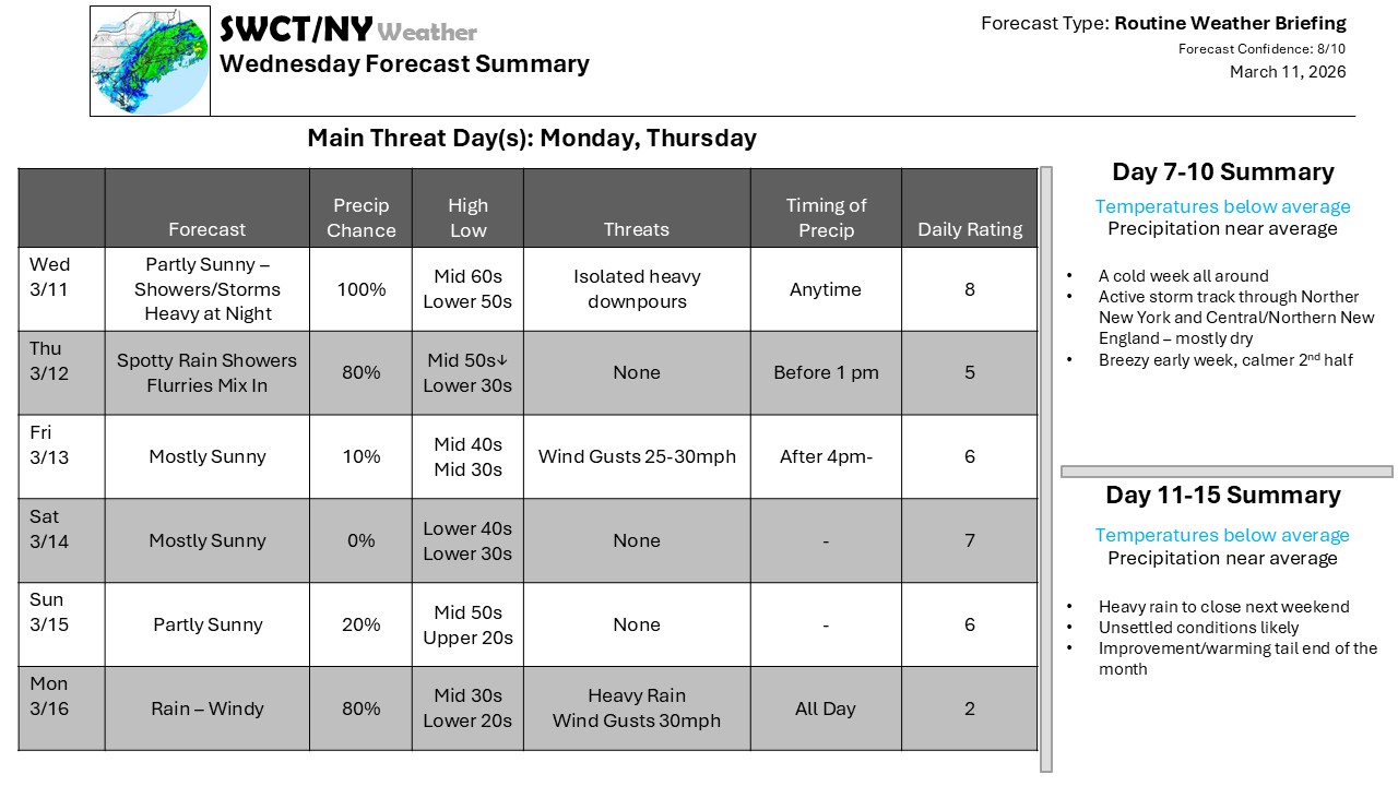
A backdoor cold front sagged southward through New England and then lifted back north – this has made for some interesting temperature swings, and while we’re back in the warm air for now, it likely doesn’t get too far north – you only have to go as far as Northern Maine to find some impactful winter weather. There is some on the backside of the approaching cold front, as well – but while that front may trigger some heavy showers and thunderstorms, the track of the storm steering the front is east-northeast, which will take much of the heavier rain, and then much of the snow, and keep it north of us. We’ll get into that cooler air mass pushing through the Great Lakes, but miss the full return to winter weather.
This weather system is part of a series along a series of frontal boundaries, and by Sunday, another wave tracks farther north, which brings temperatures back up and brings rain back in – and then we do it all again with a falling temperature and a generally cool week next week.
Don’t forget to update your account on the new swctweather.com. Make sure to update your password so you can still login as we complete the transition process.
