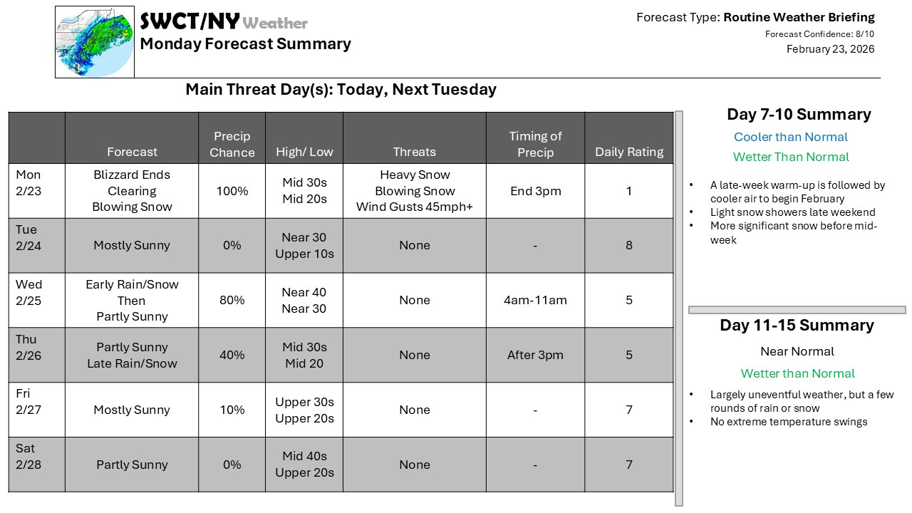
After what was in some areas an historic blizzard, the Nor’easter has pulled away from New England, and quieter weather settles in now. There is a quick-moving trough that will clip across the region Tuesday Night, bringing a few hours of light snow – a quick accumulation of an inch or so is possible, with the chance for some rain to mix in by midday Wednesday before the snow ends. But no sooner does the snow pick up, it ends and we dry out before another quick system brings some snow or rain later Thursday.
Warmer air follows for Friday and Saturday; February ends on a warm note before March begins on a cooler note; we’ll be watching for another storm to follow with the cold air for potential accumulating snow.
We have completed the incorporation of SWCT/NY Weather into National Weather Forecasting, Inc. All user accounts are now active on the new website, but you may have to change your password. We’ll be reaching out with special renewal offers out on a rolling schedule based on subscription renewal dates, but for now, you will be able to access the products on the website even if your subscription lapses.
-Phil Spevak
