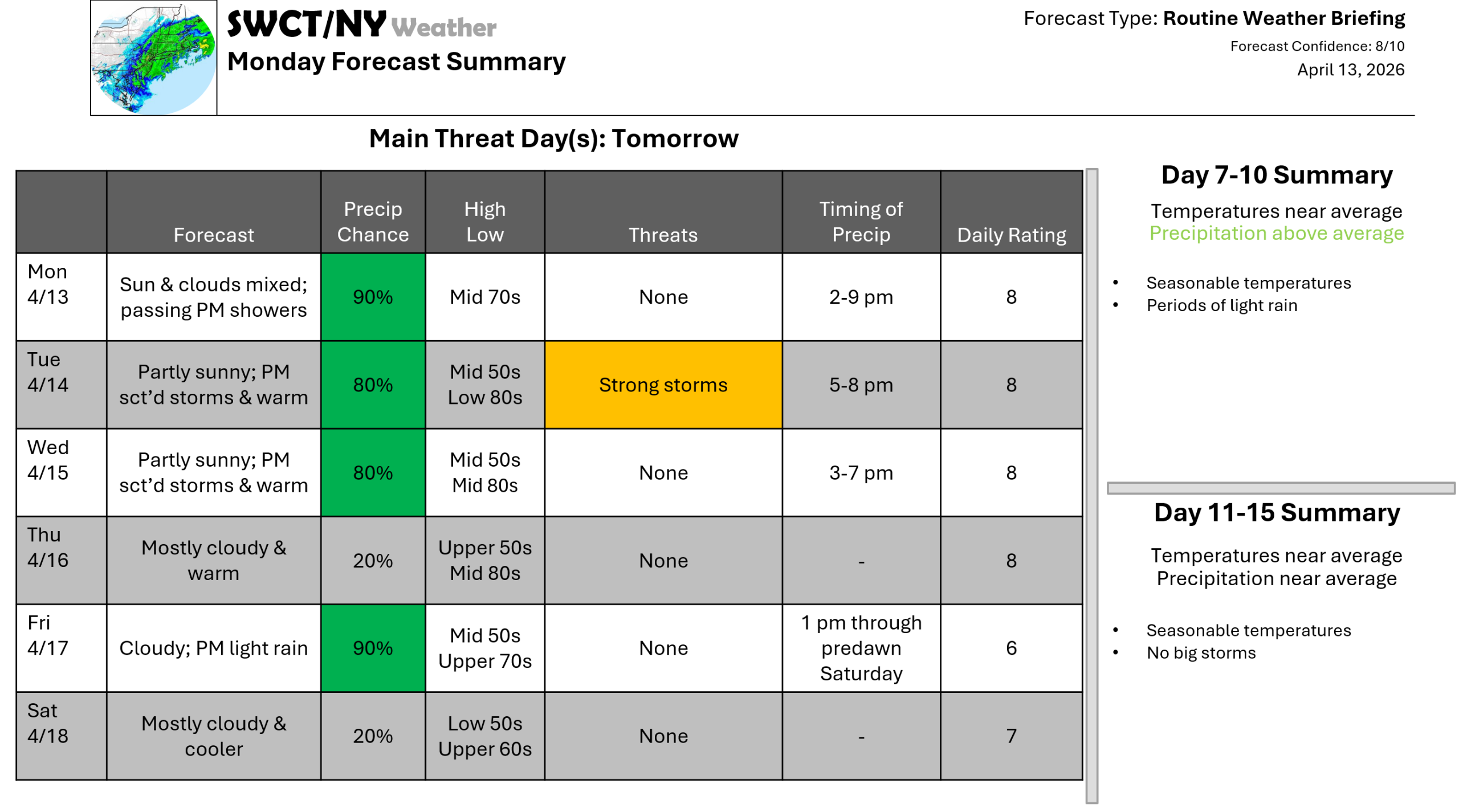
Good afternoon! Through week’s end; we are a bit unsettled at times. We run a risk of passing showers this afternoon with hit & miss strong thunderstorms tomorrow & Wednesday afternoon as some energy moves through from our west. Storms will be capable of producing strong wind gusts up to 50 mph. The main weather story will be the major warmup that begins today & that lasts through Friday. It will be cooler though at the coast with high temperatures in the mid 60s to mid 70s thanks to the wind off the much cooler water. We’ll see varying cloud cover through the week. Much cooler temperatures near normal arrives by the start of next week as a robust cold front moves through from the Great Lakes.
– Joe Sciacca
Be sure to update your account on the new swctweather.com/nationalweatherforecastinginc.com and watch for a resubscribe/renewal special in your inbox
