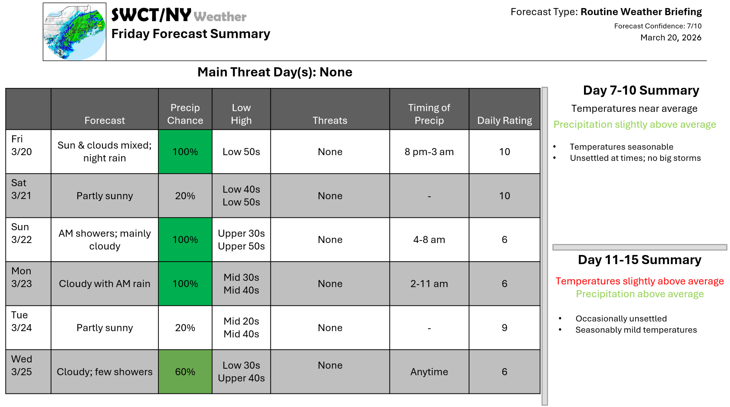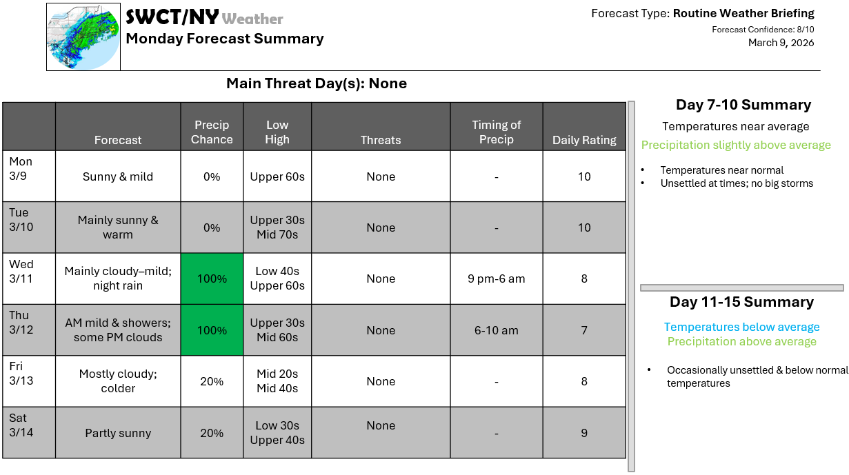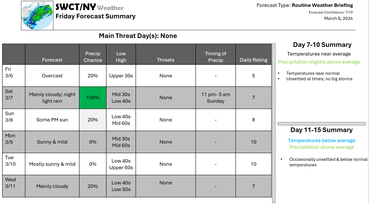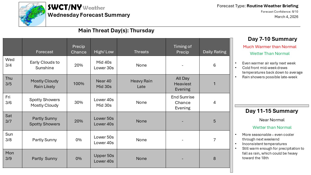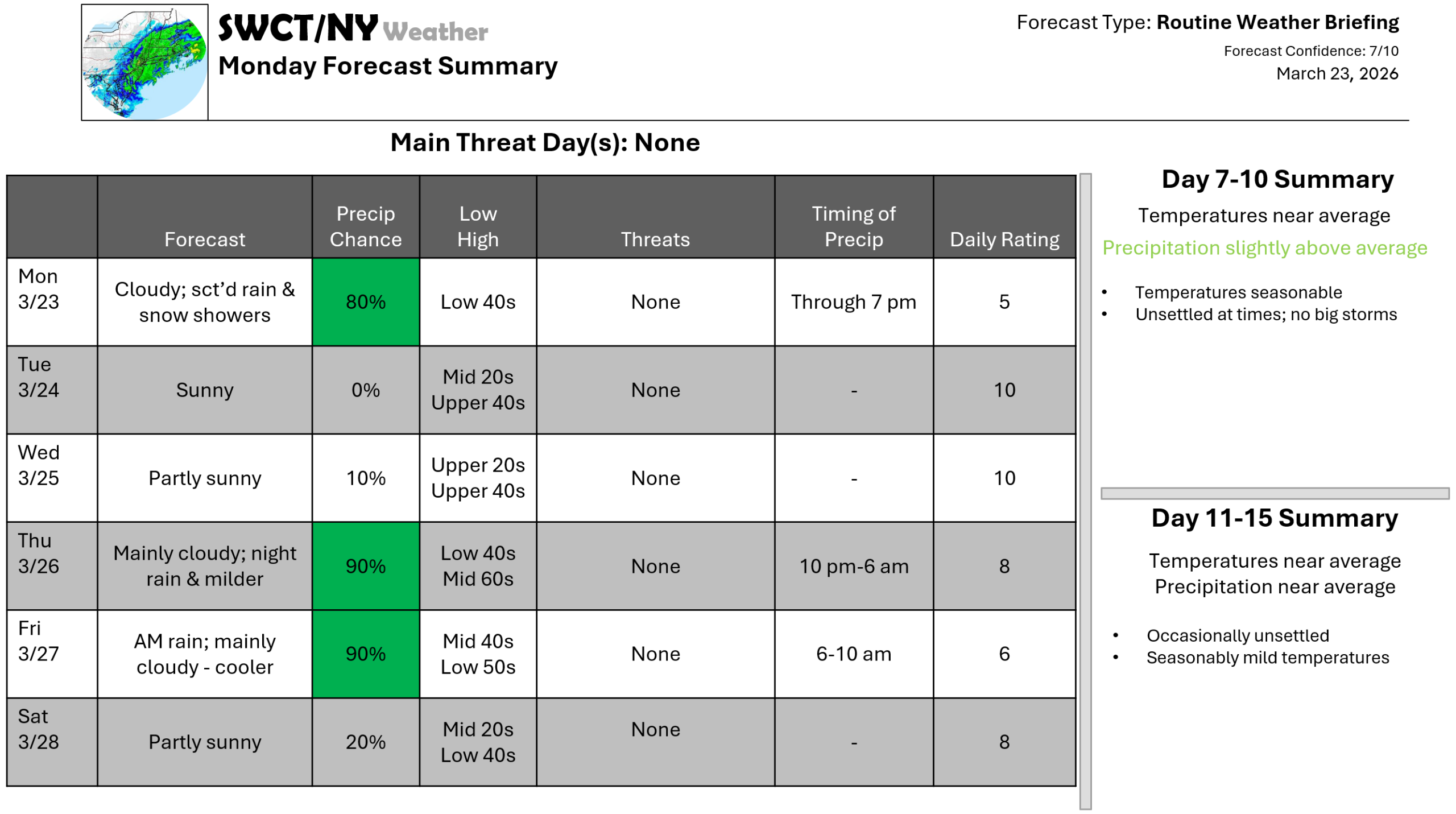
Good afternoon! Hit & miss rain & snow showers are forecasted through early this evening as some energy moves through form our north. Strong surface high pressure builds in from the Great Lakes overnight setting up a great Tuesday! Clouds increase tomorrow night with more clouds Wednesday as some energy passes by to our north. Another round of energy moving in from the Great Lakes Thursday offers a risk of showers by late Thursday evening lasting through Friday late morning as this batch of energy moves through. Thursday features the mildest day of the week out ahead of our next batch of widespread rain. Clouds will be the theme much of the time through early next week. – Joe Sciacca
Don’t forget to update your account on the new swctweather.com. Make sure to update your password so you can still login as we complete the transition process.