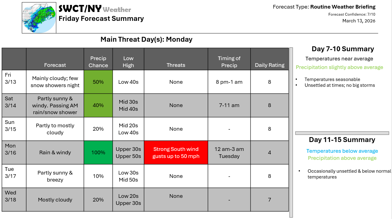
Good afternoon! Surface high pressure across the region provides us with a mix of sun & clouds today with seasonable temperatures & a bit of a southerly breeze this afternoon. Strong west wind gusts up to 40 mph are expected tomorrow as a robust storm system passes by to our north & northeast & as surface high pressure builds in from the Great Lakes. Some snow showers are possible this evening & a passing rain & or snow shower tomorrow morning as this storm system passes by to our north. A rebound in temperatures arrives Monday out ahead of a strong cold front moving through from the Great Lakes which also brings even more rain & the potential for strong south wind gusts up to 50 mph. Behind this cold front; much cooler air moves in from the Great Lakes for the remainder of next week as strong surface high pressure settles in with varying cloud cover. Joe Sciacca
Don’t forget to update your account on the new swctweather.com. Make sure to update your password so you can still login as we complete the transition process.
