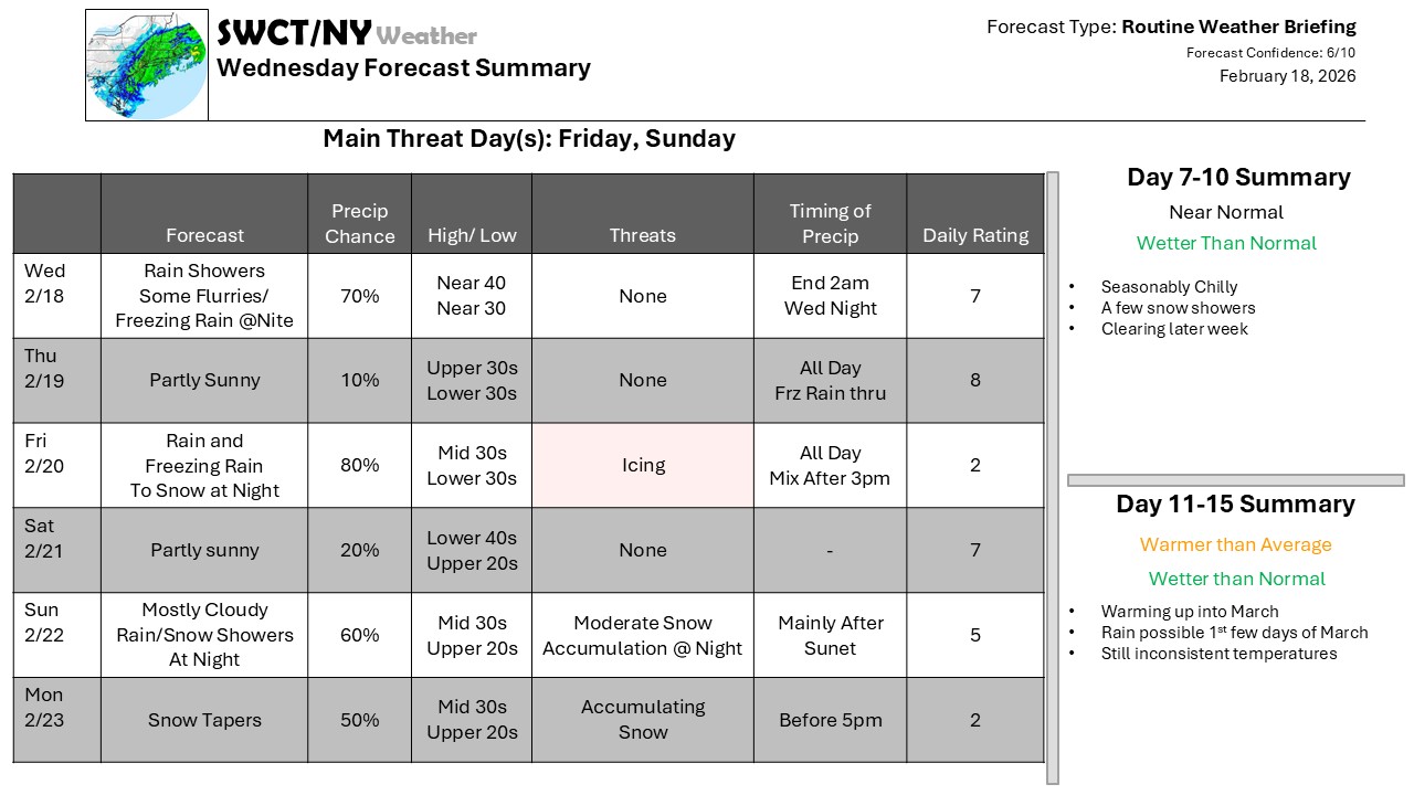
A very active weather pattern continues over the next few weeks with some type of weather system affecting the region every few days. The next few bring some winter weather thanks to a warm front sitting off to our south – some freezing rain will be possible with light icing on Friday before some accumulating snow on the back side of that wave and then again with the next Sunday Night. At this point, it still looks like this will not be a major snowstorm, but it certainly could be a significant accumulation.
Beyond that, the rate may slow to every 3 days, but the active pattern continues
-Phil Spevak
