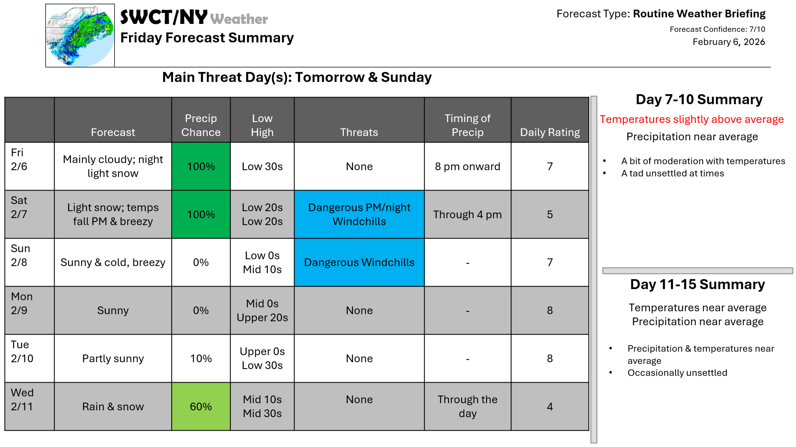
Good afternoon! No big storms are in sight for at least the next week as the pattern remains fast moving across this part of the world. Temperatures remain a tad below normal this afternoon with a more robust shot of cold air by tomorrow afternoon arriving from central & northern Canada as part of the Polar Vortex moves by overhead and some energy moves through from the eastern Great Lakes offering light snow late this evening through tomorrow late afternoon. The bulk of snow moves overnight with 1-2″ forecasted. Dangerous windchills of -15 to -25 are expected tomorrow night & Sunday night. Seasonable temperatures are expected by mid next week as a pattern change occurs across North America. A weak storm system moving through from the Great Lakes Wednesday looks to offer a mix of rain & snow showers.
-Joe Sciacca
