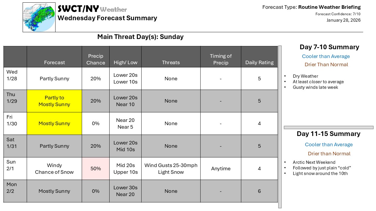
There is a lot of cloud cover around the northeast, but not necessarily a lot of precipitation; it’s mainly lake-driven snow showers close to the Great Lakes, with some of the weak disturbances moving through the broad upper-level trough picking up just enough of that moisture to trigger a flurry or two. None of this will produce significant snow.
We’ll be watching a system near the coast this weekend; it develops off the Carolina coast Friday then lifts northward, and our expectation is it will move primarily offshore. Even so, it will have an expansive enough wind field to kick up northerly winds into the 10-20 mph range with gusts 25-30 so Sunday, with little more than an inch or two of snow. Generally dry weather prevails right through the first third of February – but we can thank a persistent Arctic airmass to our north for providing the block.
We’re moving to a new website. Your access will continue uninterrupted. Resubscribe special coming next week.
