Issued: Monday, July 28, 2025 7:00 am
Key Take-Aways Next Ten Days:
- High heat & humidity for many through Wednesday; cooler late week & weekend
- No major storm systems in sight
Discussion: Through Wednesday much of the region will see high heat & high humidity leading to dangerous heat index values of 95-105 during the afternoons. The pattern change that was foreseen last Monday was a bit shorter than forecasted. A robust cold front moves through the region starting Wednesday across the northern parts of the region bringing showers & storms which have the potential to be strong to severe being capable of producing strong to damaging wind gusts. This cold front slows as it pushes south across the central & southern parts of the region providing additional showers & storms with a much lower severe storm risk than Wednesday as of now. By late week & weekend; surface high pressure builds in from southern Canada providing cooler temperatures slightly below normal & lower humidity.
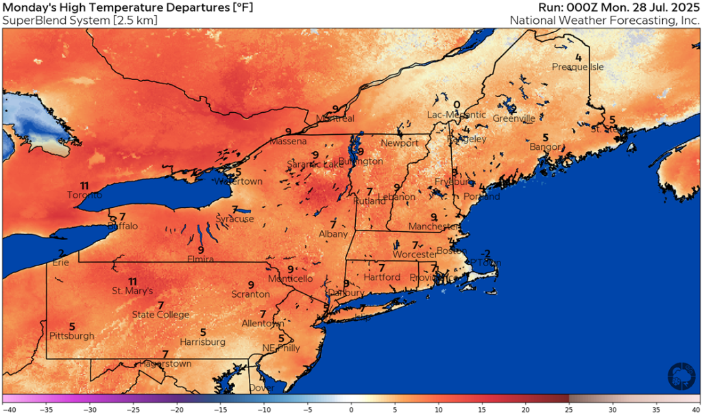
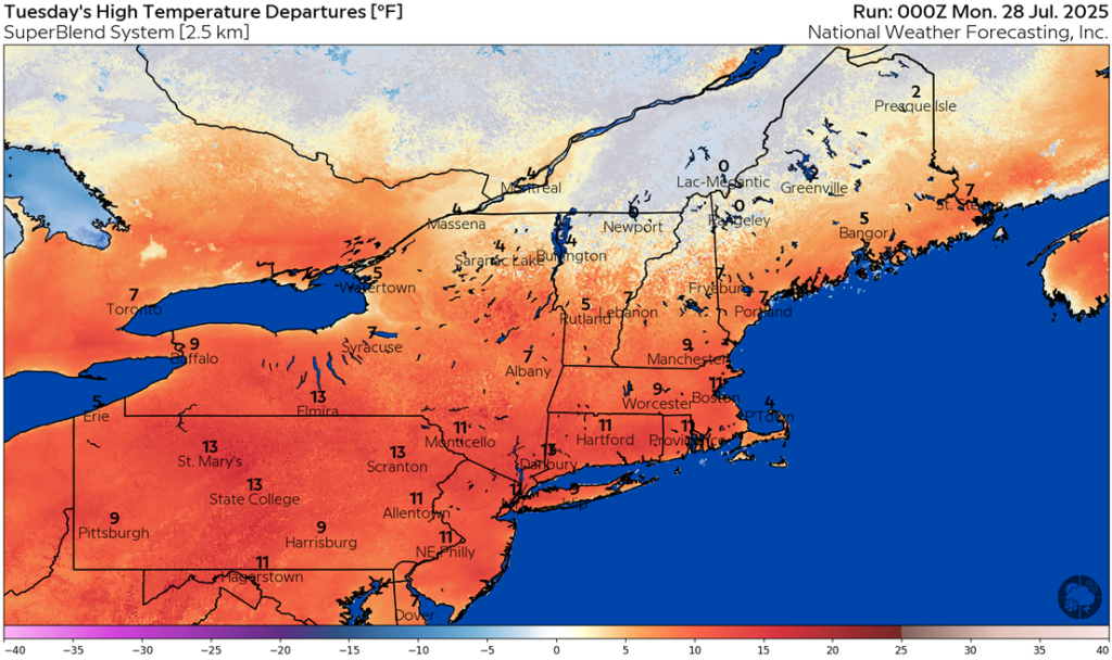
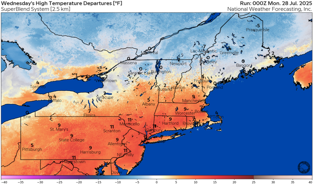
As seen on the maps below, high temperatures are forecasted to be above to well above normal for many. By Wednesday, high temperatures are forecasted to cool to below normal across far northern areas as the cold front begins to move south across the region. Above to well above normal high temperatures continue for the remainder of the region.
August likely favors temperatures slightly above normal (1-3 degrees) with varying levels of humidity.
Please note that we now have available ten-day temperature anomaly graphics available for the northeastern domain on your energy analysis dashboard.
For daily updated degree day forecasts and degree day totals, please consult your individual market on our Energy Analysis Dashboard at: https://www.nationalweatherforecastinginc.com/nefi/
Questions? Call (201) 427-1119
Next Update: Next Monday or storm updates as needed!